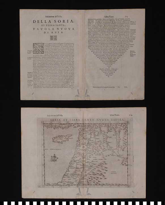
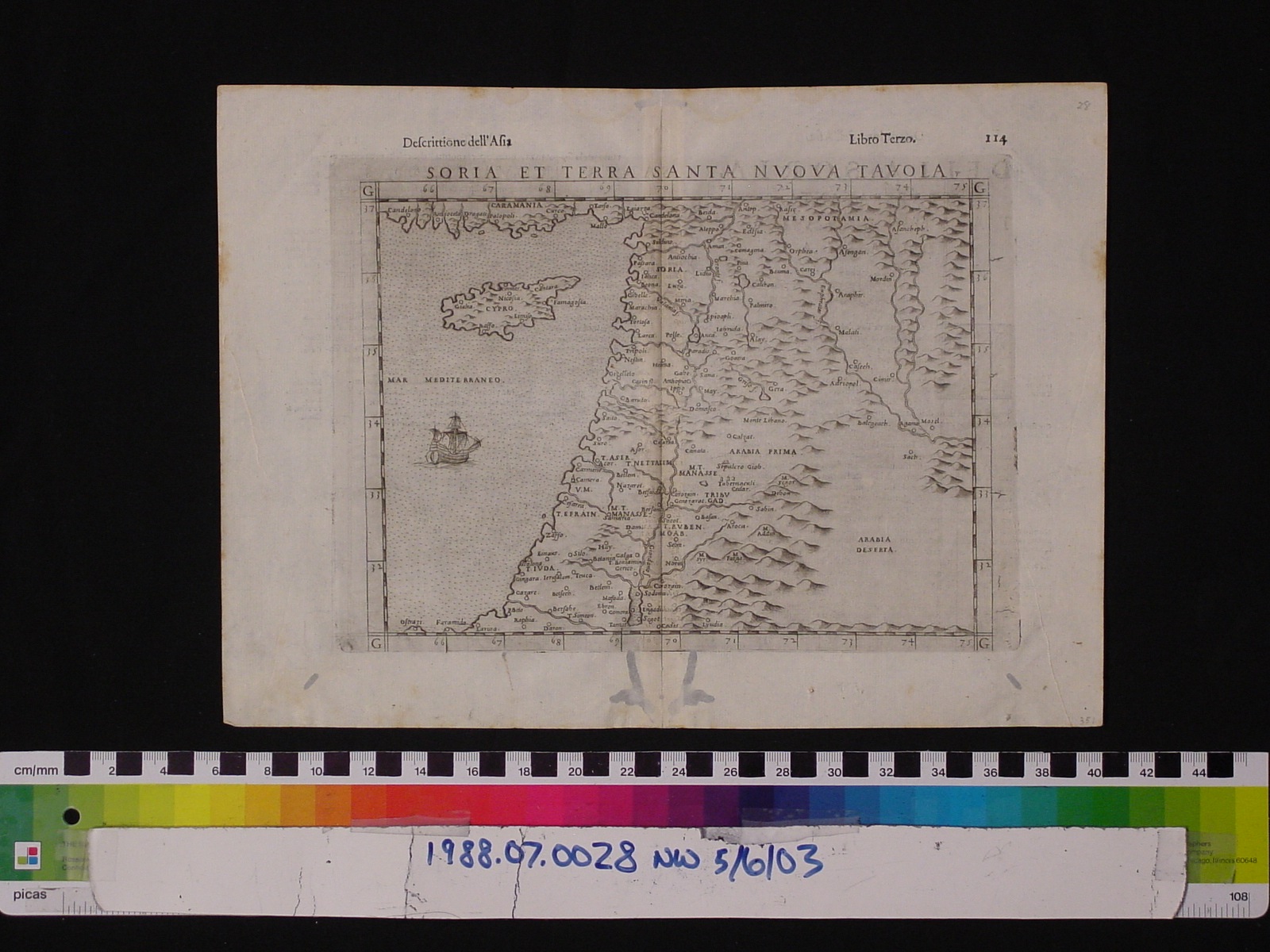
Map: Soria et Terra Santa Nuova Tavola
1988.07.0028
Detailed Images
Basic Information
| Artifact Identification | Map: Soria et Terra Santa Nuova Tavola (1988.07.0028) |
|---|---|
| Classification/ Nomenclature |
|
| Artist/Maker | Ptolemy's Universal Geography (c. 100-170 AD) Rosaccio, Giuseppe: Editor (c. 1530-1620) after an edition by Girolamo Ruscelli (c. 1500-1566) The heirs of Melchior Sessa: Publishers |
| Geographic Location | |
| Period | Renaissance |
| Date | 1598-1599 CE |
| Culture | Italian, Venetian |
| Location | Not on Exhibit |
Physical Analysis
| Dimension 1 (Width) | 34.0 cm |
|---|---|
| Dimension 2 (Height) | 24.8 cm |
| Dimension 3 (Depth) | <0.1 cm |
| Weight | 6 g |
| Measuring Remarks | N/A |
| Materials | paper, pigment--ink |
| Manufacturing Processes | Printed |
Research Remarks
| Description | N/A |
|---|---|
| Published Description | Under Review |
| Bibliography | Stevens, Henry Newton and Edward Everett Ayer. Ptolemy's geography: a brief account of all the printed editions down to 1730... pg. 19, 56. London: Stevens, Son and Stiles, 1908. |
Artifact History
| Credit Line/Dedication | The Seymour and Muriel Yale Collection of Coins of the Ottoman Empire and Other Middle East States |
|---|---|
| Reproduction | No |
Contact
All information about our collection is constantly reviewed and updated. Please contact Dery Martínez-Bonilla, Registrar, if there is any information you are looking for that isn't currently online.