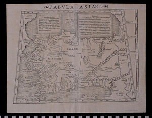
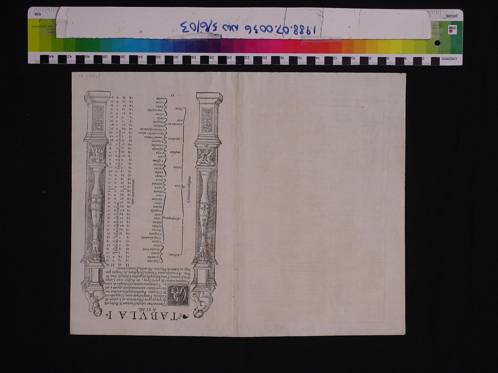
Map: Tabula Asiae I
1988.07.0036
Detailed Images
Basic Information
| Artifact Identification | Map: Tabula Asiae I (1988.07.0036) |
|---|---|
| Classification/ Nomenclature |
|
| Artist/Maker | Ptolemy, Claudius: "Universal Geography" (c. 100-170 AD) Sebastian Munster: Cartographer and Editor (1448-1552) Heinrich Petri: Publisher |
| Geographic Location | |
| Period | Renaissance |
| Date | 1542 CE |
| Culture | European |
| Location | Not on Exhibit |
Physical Analysis
| Dimension 1 (Height) | 37.5 cm |
|---|---|
| Dimension 2 (Width) | 29.6 cm |
| Dimension 3 (Depth) | <0.1 cm |
| Weight | 8 g |
| Measuring Remarks | N/A |
| Materials | paper, pigment--ink |
| Manufacturing Processes | Printed |
Research Remarks
| Description | N/A |
|---|---|
| Published Description | Under Review |
| Bibliography | McLean, Matthew. The Cosmographia of Sebastian Munster: Describing the World in the Reformation. Pg. 168. Hampshire: Ashgate Publishing Ltd., 2013. Accessed on Google Books. |
Artifact History
| Credit Line/Dedication | The Seymour and Muriel Yale Collection of Coins of the Ottoman Empire and Other Middle East States |
|---|---|
| Reproduction | no |
Contact
All information about our collection is constantly reviewed and updated. Please contact Dery Martínez-Bonilla, Registrar, if there is any information you are looking for that isn't currently online.