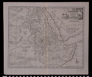
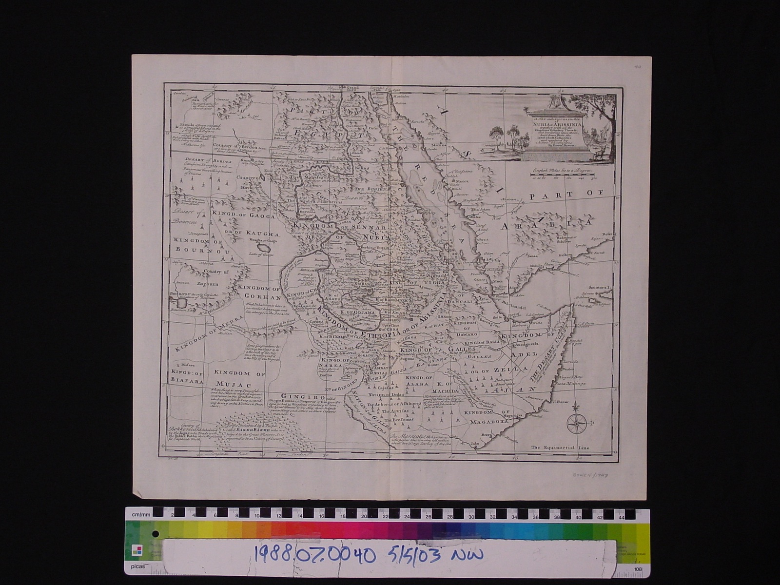
Map: A New and Accurate Map of Nubia and Abissinia
1988.07.0040
Detailed Images
Basic Information
| Artifact Identification | Map: A New and Accurate Map of Nubia and Abissinia (1988.07.0040) |
|---|---|
| Classification/ Nomenclature |
|
| Artist/Maker | Bowen, Emanuel: Publisher/ Author (1693-1747) (after) Herman Moll Printed for William Innys, Richard Ware et Al. |
| Geographic Location | |
| Period | Georgian |
| Date | 1747 |
| Culture | British, English |
| Location | Not on Exhibit |
Physical Analysis
| Dimension 1 (Width) | 48 cm |
|---|---|
| Dimension 2 (Length) | 41.3 cm |
| Dimension 3 (N/A) | N/A |
| Weight | 14 g |
| Measuring Remarks | N/A |
| Materials | paper, pigment--ink |
| Manufacturing Processes | Printed |
Research Remarks
| Description | N/A |
|---|---|
| Published Description | N/A |
| Bibliography | Perry, Thomas Melville and Dorothy Francis Prescott. A Guide to Maps of Australia in Books Published 1780-1830: An Annotated Cartobibliography. National Library Australia: 1996. Accessed on Google Books |
Artifact History
| Credit Line/Dedication | The Seymour and Muriel Yale Collection of Coins of the Ottoman Empire and Other Middle East States |
|---|---|
| Reproduction | no |
Contact
All information about our collection is constantly reviewed and updated. Please contact Dery Martínez-Bonilla, Registrar, if there is any information you are looking for that isn't currently online.