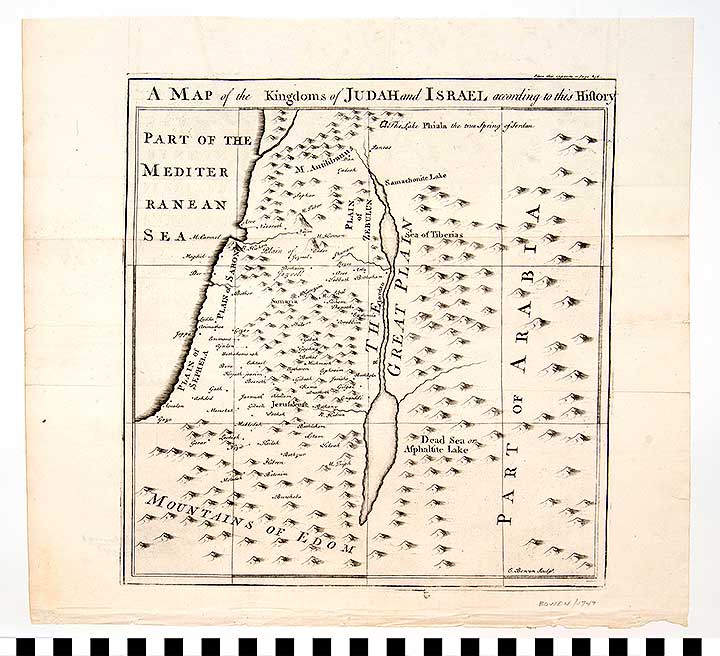
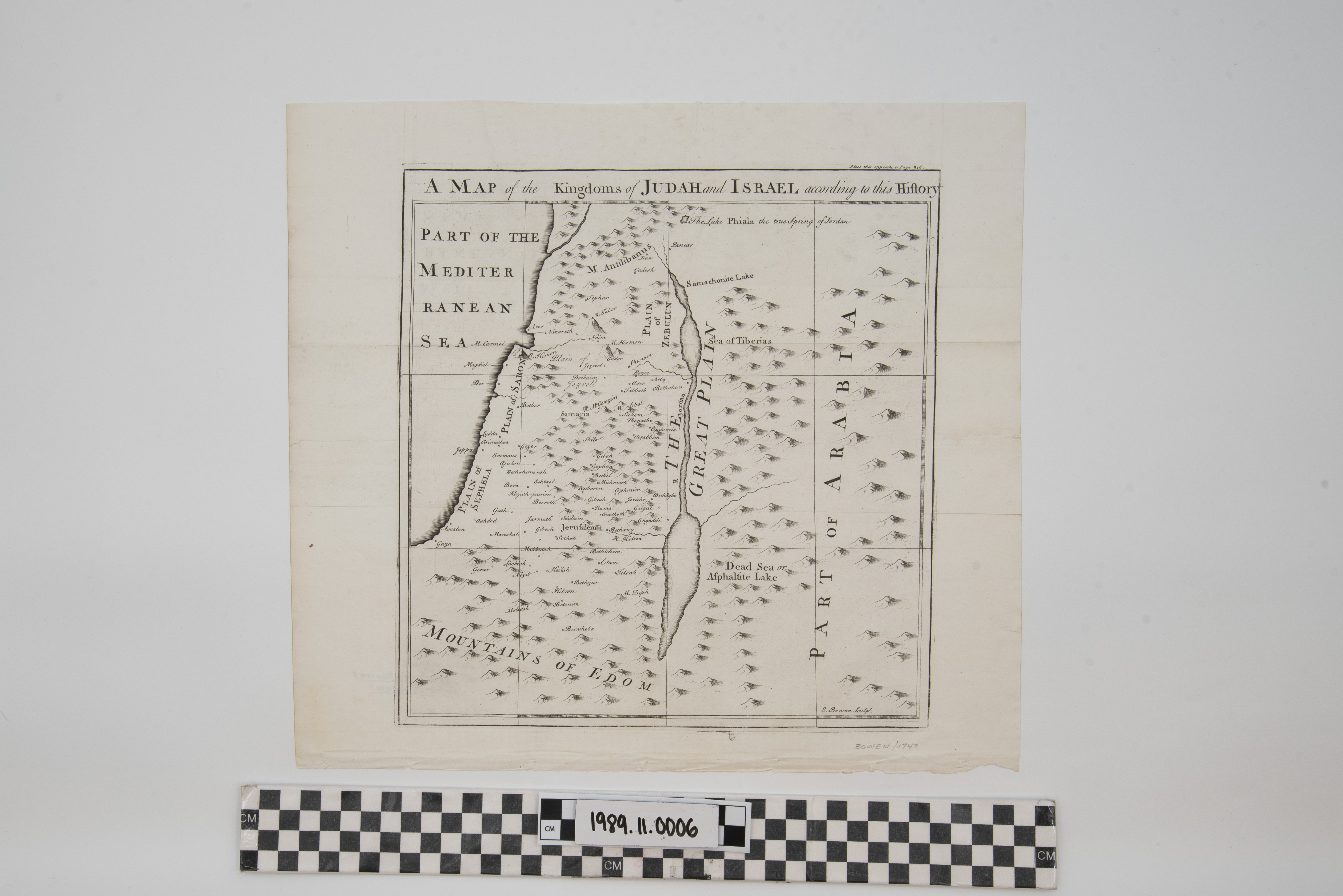
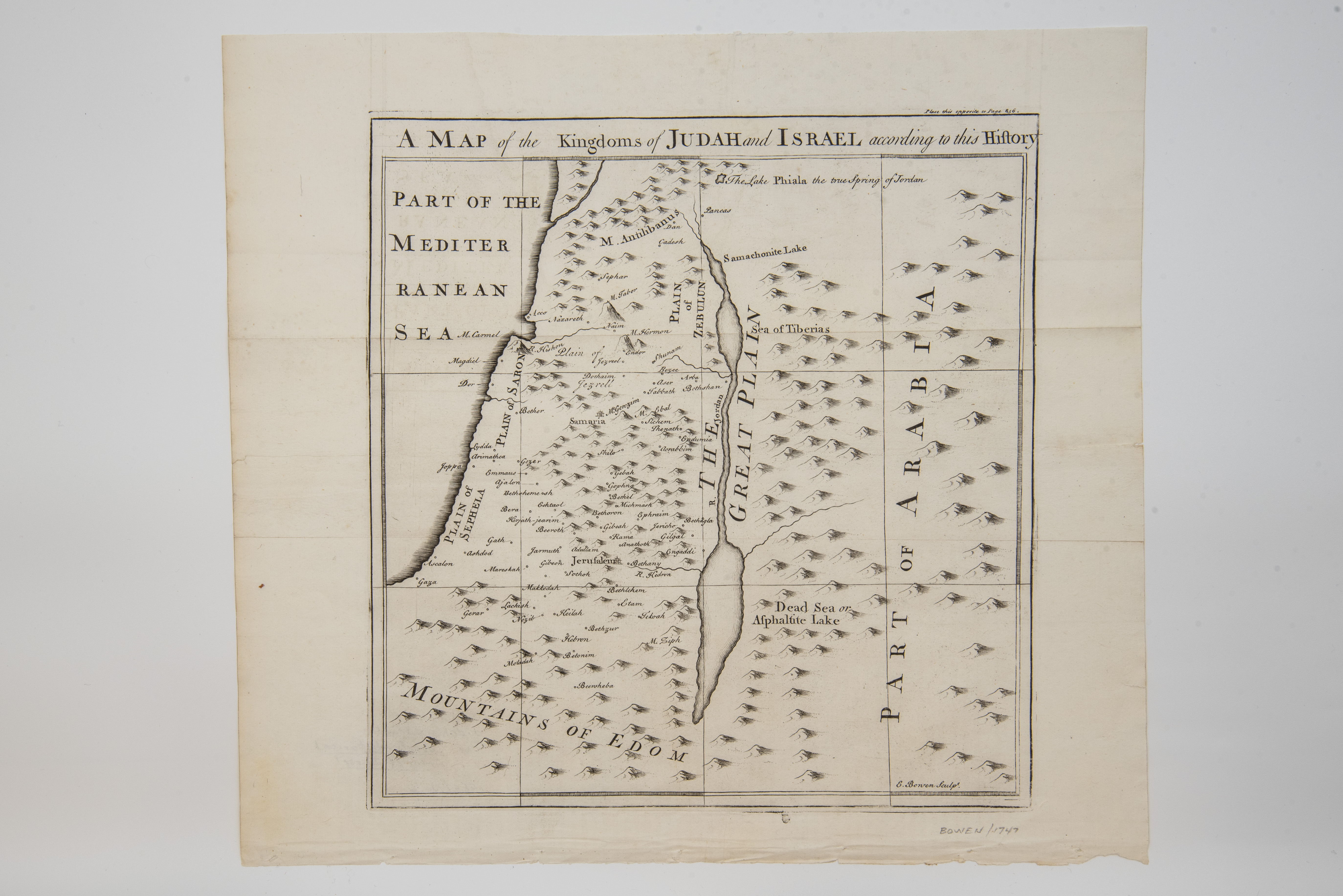
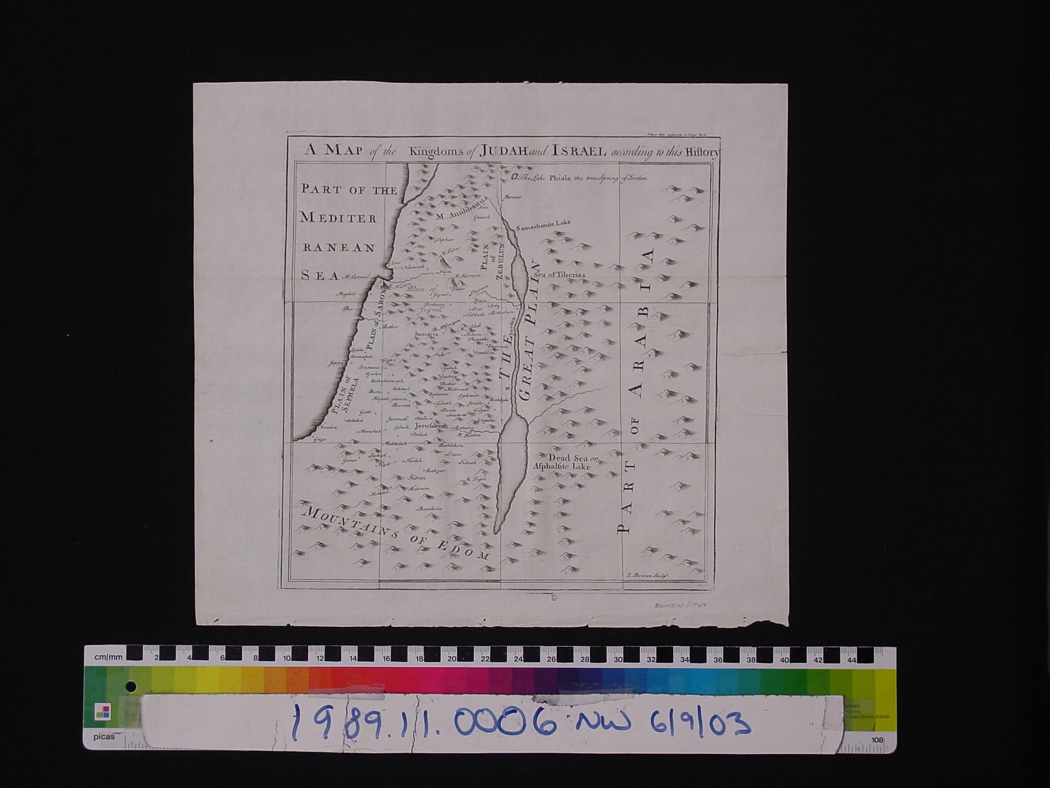
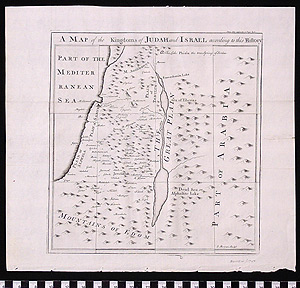
Map: Kingdoms of Judah and Israel
1989.11.0006
Detailed Images
Basic Information
| Artifact Identification | Map: Kingdoms of Judah and Israel (1989.11.0006) |
|---|---|
| Classification/ Nomenclature |
|
| Artist/Maker | Bowen, Emanuel: Engraver (1714-1767) (after) Herman Moll (c.1654-1732) William Innys, Richard Ware, et al.: Publishers |
| Geographic Location | |
| Period | N/A |
| Date | 1747 CE |
| Culture | British, English |
| Location | Not on Exhibit |
Physical Analysis
| Dimension 1 (Length) | 35.9 cm |
|---|---|
| Dimension 2 (Width) | 32.8 cm |
| Dimension 3 (N/A) | N/A |
| Weight | 9 g |
| Measuring Remarks | N/A |
| Materials | Paper--rag, Pigment--ink |
| Manufacturing Processes | Printed |
Research Remarks
| Description | N/A |
|---|---|
| Published Description | Under Review |
| Bibliography | Williams, Glyndwr. The Great South Sea: English Voyages and Encounters, 1570-1750. P. 252-3. New Haven: Yale University Press, 1997. |
Artifact History
| Credit Line/Dedication | The Seymour and Muriel Yale Collection of Coins of the Ottoman Empire and Other Middle East States |
|---|---|
| Reproduction | No |
Contact
All information about our collection is constantly reviewed and updated. Please contact Dery Martínez-Bonilla, Registrar, if there is any information you are looking for that isn't currently online.