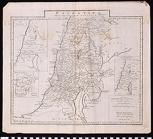
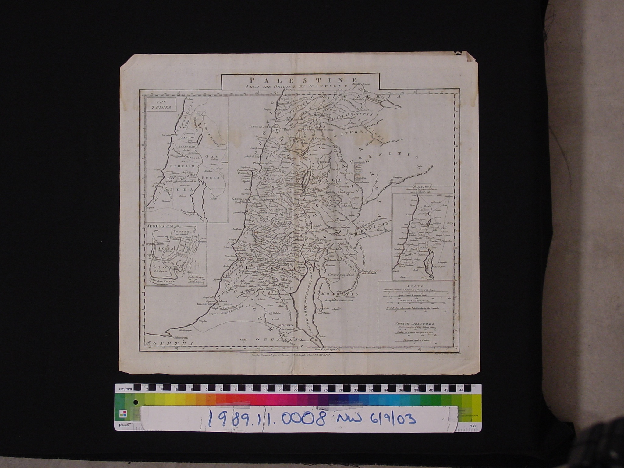
Map: Palestine
1989.11.0008
Detailed Images
Basic Information
| Artifact Identification | Map: Palestine (1989.11.0008) |
|---|---|
| Classification/ Nomenclature |
|
| Artist/Maker | Harrison, J.: Publisher (active 1784-1792) (after) Jean Baptiste Bourguignon d'Anville (1697-1782) G. Terry of Paternoster Row (Garnet?): Engraver Full publication is by G. Allen, J. Haywood, G. Terry, and T. Bowen |
| Geographic Location | |
| Period | N/A |
| Date | 1788 CE |
| Culture | British, English |
| Location | Not on Exhibit |
Physical Analysis
| Dimension 1 (Width) | 48.2 cm |
|---|---|
| Dimension 2 (Height) | 41.8 cm |
| Dimension 3 (Depth) | <0.1 cm |
| Weight | 13 g |
| Measuring Remarks | N/A |
| Materials | Paper--rag, Pigment--ink |
| Manufacturing Processes | Printed |
Research Remarks
| Description | N/A |
|---|---|
| Published Description | Under Review |
| Bibliography | Brown, Lloyd A. Mapmaking: The Art That Became a Science.Chap. IV, "Ptolemy's Rules for Mapmakers." Boston and Toronto: Little, Brown and & Company, 1960. |
Artifact History
| Credit Line/Dedication | The Seymour and Muriel Yale Collection of Coins of the Ottoman Empire and Other Middle East States |
|---|---|
| Reproduction | no |
Contact
All information about our collection is constantly reviewed and updated. Please contact Dery Martínez-Bonilla, Registrar, if there is any information you are looking for that isn't currently online.