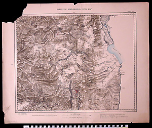
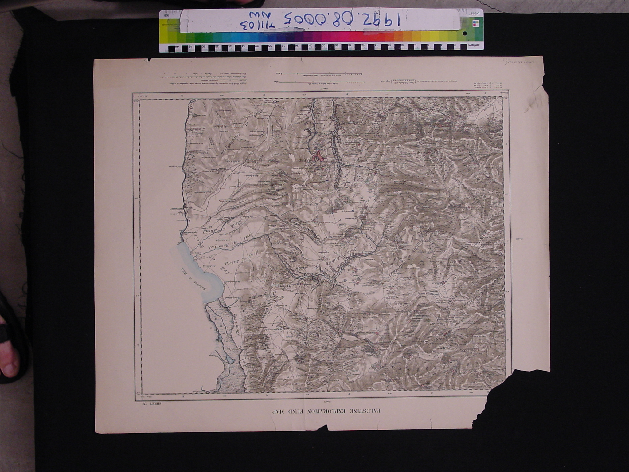
Map: Palestine Exploration Fund Map - Sheet IV
1992.08.0005
Detailed Images
Basic Information
| Artifact Identification | Map: Palestine Exploration Fund Map - Sheet IV (1992.08.0005) |
|---|---|
| Classification/ Nomenclature |
|
| Artist/Maker | Conder, Claude Reignier and Kitchener, Horatio Herbert. Map of Western Palestine from Surveys conducted for the Committee of the Palestine Exploration Fund by Lieuts. C.R. Conder and H.H. Kitchener. |
| Geographic Location | |
| Period | N/A |
| Date | 1875 to 1900 CE, May 1878 CE |
| Culture | British, English |
| Location | Not on Exhibit |
Physical Analysis
| Dimension 1 (Width) | 68.0 cm |
|---|---|
| Dimension 2 (Height) | 55.8 cm |
| Dimension 3 (Depth) | <0.1 cm |
| Weight | 53 g |
| Measuring Remarks | N/A |
| Materials | paper, pigment |
| Manufacturing Processes | Printed |
Research Remarks
| Description | N/A |
|---|---|
| Published Description | N/A |
| Bibliography | Under Review |
Artifact History
| Credit Line/Dedication | The Seymour and Muriel Yale Collection of Coins of the Ottoman Empire and Other Middle East States |
|---|---|
| Reproduction | no |
Contact
All information about our collection is constantly reviewed and updated. Please contact Dery Martínez-Bonilla, Registrar, if there is any information you are looking for that isn't currently online.