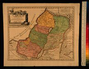
Map: Terra Sancta in XII olim Tribus nunch VI Provincias dispertita, Holyland
1993.23.0018
Basic Information
| Artifact Identification | Map: Terra Sancta in XII olim Tribus nunch VI Provincias dispertita, Holyland (1993.23.0018) |
|---|---|
| Classification/ Nomenclature |
|
| Artist/Maker | Weigel, Christophor, the Elder Atlas manualis, Nurnberg, 1724. Drawn after G. Sanson |
| Geographic Location | |
| Period | N/A |
| Date | 1720 CE |
| Culture | English, British |
| Location | Not on Exhibit |
Physical Analysis
| Dimension 1 (Width) | 44.6 cm |
|---|---|
| Dimension 2 (Height) | 37.4 cm |
| Dimension 3 (Depth) | <0.1 cm |
| Weight | 18 g |
| Measuring Remarks | N/A |
| Materials | Paper, Pigment |
| Manufacturing Processes | Printed |
Research Remarks
| Description | N/A |
|---|---|
| Published Description | N/A |
| Bibliography | Laor, Eran. Maps of the Holy Land: Cartobibliography of Printed Maps, 1475-1900. New York: A. R. Liss, 1986. Catalog #829. |
Artifact History
| Credit Line/Dedication | The Seymour and Muriel Yale Collection of Coins of the Ottoman Empire and Other Middle East States |
|---|---|
| Reproduction | no |
Contact
All information about our collection is constantly reviewed and updated. Please contact Dery Martínez-Bonilla, Registrar, if there is any information you are looking for that isn't currently online.