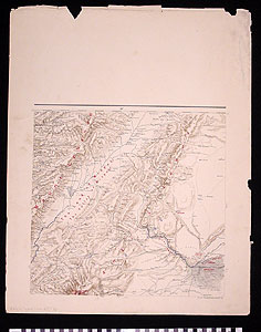
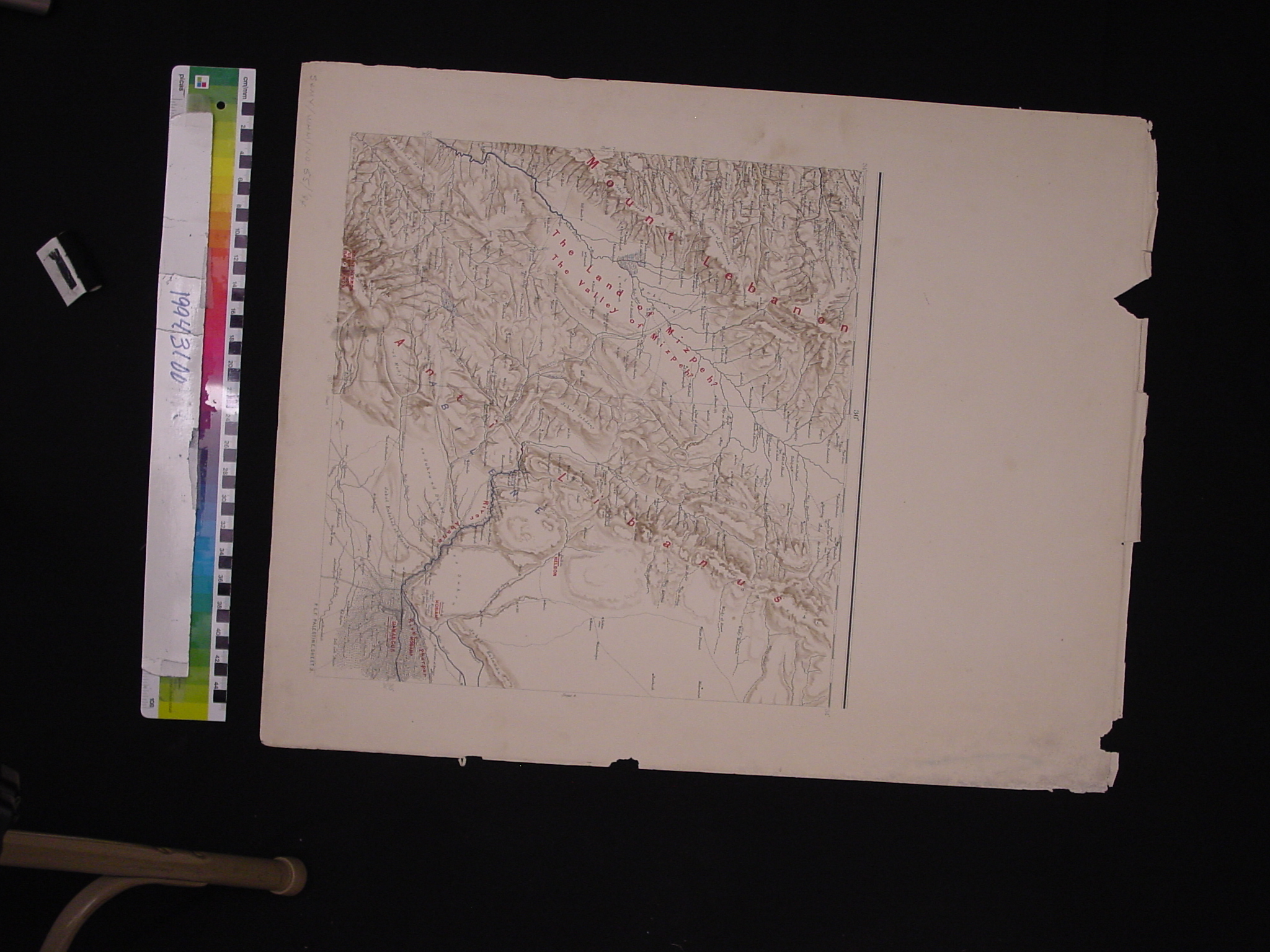
Map: Palestine Exploration Fund, Sheet 3: The Land of Mizpeh
1994.31.0055
Detailed Images
Basic Information
| Artifact Identification | Map: Palestine Exploration Fund, Sheet 3: The Land of Mizpeh (1994.31.0055) |
|---|---|
| Classification/ Nomenclature |
|
| Artist/Maker | armstrong Palestine from the Surveys Conducted for the Committee of the Palestine Exploration Fund (P.E.F.) and Other Sources. Compiled by George Armstrong and revised by Colonel Sir Charles W. Wilson K. C. B., F. R. S. and Major C. R. Conder, D. C. L., R. E. (London 1890) |
| Geographic Location | |
| Period | N/A |
| Date | 1875 to 1900 CE, 1890 CE |
| Culture | English |
| Location | Not on Exhibit |
Physical Analysis
| Dimension 1 (N/A) | 63.6 cm |
|---|---|
| Dimension 2 (N/A) | 50.8 cm |
| Dimension 3 (N/A) | N/A |
| Weight | 43 g |
| Measuring Remarks | N/A |
| Materials | paper |
| Manufacturing Processes | Printed |
Research Remarks
| Description | N/A |
|---|---|
| Published Description | N/A |
| Bibliography | Under Review |
Artifact History
| Credit Line/Dedication | The Seymour and Muriel Yale Collection of Coins of the Ottoman Empire and Other Middle East States |
|---|---|
| Reproduction | no |
Contact
All information about our collection is constantly reviewed and updated. Please contact Dery Martínez-Bonilla, Registrar, if there is any information you are looking for that isn't currently online.