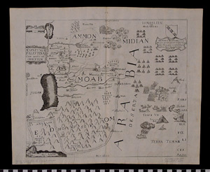
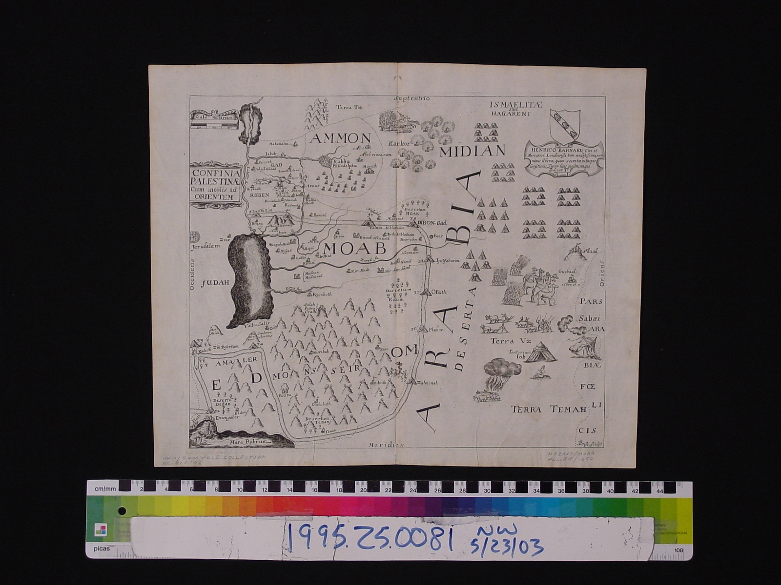
Map: Confinia Palestinae (Ammon, Midian, and Moab )
1995.25.0081
Detailed Images
Basic Information
| Artifact Identification | Map: Confinia Palestinae (Ammon, Midian, and Moab ) (1995.25.0081) |
|---|---|
| Classification/ Nomenclature |
|
| Artist/Maker | Fuller, Thomas: Author (1608-1661) Thomas Cross: Engraver Henrico Barnard: Sponsors/ dedication Originally printed by J.F. for John Williams (Publisher) in 1650 |
| Geographic Location | |
| Period | N/A |
| Date | 1650 CE |
| Culture | British, English |
| Location | Not on Exhibit |
Physical Analysis
| Dimension 1 (Width) | 39.9 cm |
|---|---|
| Dimension 2 (Height) | 32.5 cm |
| Dimension 3 (Depth) | <0.1 cm |
| Weight | 9 g |
| Measuring Remarks | N/A |
| Materials | paper, pigment--ink |
| Manufacturing Processes | Printed |
Research Remarks
| Description | N/A |
|---|---|
| Published Description | Under Review |
| Bibliography | Fuller, Thomas. A Pisgah Sight of Palestine. London, John Williams, 1650. |
Artifact History
| Credit Line/Dedication | In memory of Muriel Yale. |
|---|---|
| Reproduction | no |
Contact
All information about our collection is constantly reviewed and updated. Please contact Dery Martínez-Bonilla, Registrar, if there is any information you are looking for that isn't currently online.