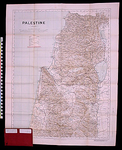
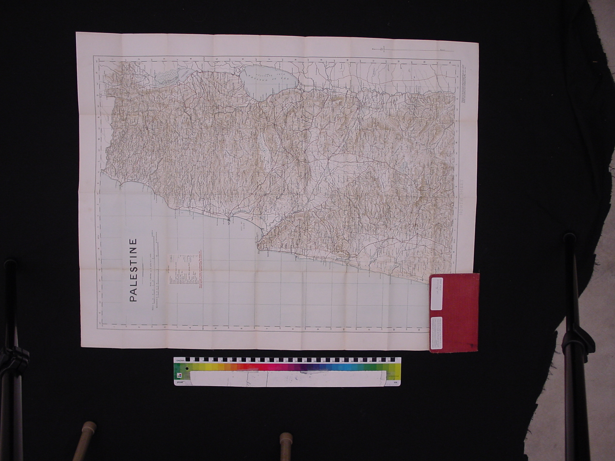
Map: Palestine/ North Sheet
1997.11.0036
Detailed Images
Basic Information
| Artifact Identification | Map: Palestine/ North Sheet (1997.11.0036) |
|---|---|
| Classification/ Nomenclature |
|
| Artist/Maker | Conder and Kitchener. Surveys conducted for the Committee of the Palestine Exploration Fund by Lieuts. C. R. Conder and H. H. Kitchener, Royal Engineers, 1881 and printed with corrections and additions at the British War Office, 1915. |
| Geographic Location | |
| Period | World War I |
| Date | 1915 |
| Culture | British, English |
| Location | Not on Exhibit |
Physical Analysis
| Dimension 1 (Height) | 85.3 cm |
|---|---|
| Dimension 2 (Width) | 65.8 cm |
| Dimension 3 (Depth) | 1.5 cm |
| Weight | 104 g |
| Measuring Remarks | Under Review |
| Materials | Pigment--Ink, Paper |
| Manufacturing Processes | Printing |
Research Remarks
| Description | N/A |
|---|---|
| Published Description | N/A |
| Bibliography | Under Review |
Artifact History
| Credit Line/Dedication | The Seymour and Muriel Yale Collection of Coins of the Ottoman Empire and Other Middle East States |
|---|---|
| Reproduction | No |
Contact
All information about our collection is constantly reviewed and updated. Please contact Dery Martínez-Bonilla, Registrar, if there is any information you are looking for that isn't currently online.