Search Results
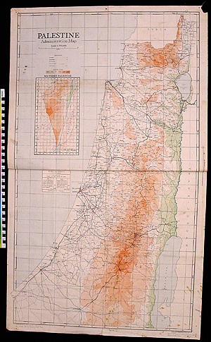
Map: Palestine1997.11.0040 (1997.11.0040)
101.1 x 59.9 x .1 cm (98 g)
Location: Europe, West: United Kingdom: Great Britain
Period: World War II; 1936
Classification/Nomenclature: Communication Artifacts : Documentary Artifacts : Graphic Documents
Period: World War II; 1936
Classification/Nomenclature: Communication Artifacts : Documentary Artifacts : Graphic Documents
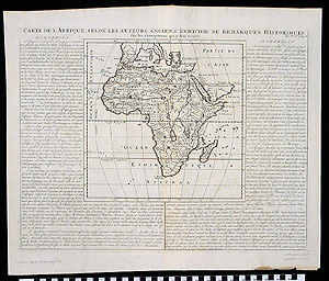
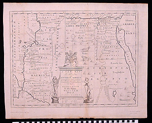
Map: Ancient Africa1997.11.0041 (1997.11.0041)
53.5 x 44.5 x .1 cm (21 g)
Location: Europe, West: France
Period: 1719
Classification/Nomenclature: Communication Artifacts : Documentary Artifacts : Graphic Documents
Period: 1719
Classification/Nomenclature: Communication Artifacts : Documentary Artifacts : Graphic Documents
Map: Constantinople1997.11.0042 (1997.11.0042)
53.5 x 45.8 x .1 cm (19 g)
Period: 1719
Classification/Nomenclature: Communication Artifacts : Documentary Artifacts : Graphic Documents
Classification/Nomenclature: Communication Artifacts : Documentary Artifacts : Graphic Documents
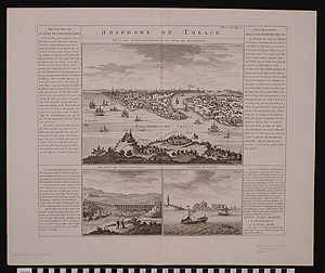
Map: Bosphorus de Thrace1997.11.0043 (1997.11.0043)
53.9 x 44.7 x .1 cm (24 g)
Period: 1719
Classification/Nomenclature: Communication Artifacts : Documentary Artifacts : Graphic Documents
Classification/Nomenclature: Communication Artifacts : Documentary Artifacts : Graphic Documents
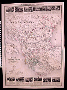
Map: Turkey in Europe and Greece1997.11.0044 (1997.11.0044)
89.6 x 64.9 x .1 cm (79 g)
Location: Europe, West: France: Paris: Paris
Period: 1860 CE
Classification/Nomenclature: Communication Artifacts : Documentary Artifacts : Graphic Documents
Period: 1860 CE
Classification/Nomenclature: Communication Artifacts : Documentary Artifacts : Graphic Documents
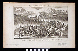
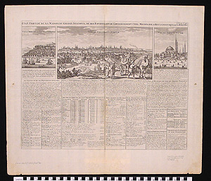
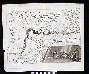
Map: The March Of The Grand Caravan From Cairo To Mecca1997.11.0045 (1997.11.0045)
36.7 x 23 x .1 cm (9 g)
Period: 1778-1779 CE.
Classification/Nomenclature: Communication Artifacts : Documentary Artifacts : Graphic Documents
Classification/Nomenclature: Communication Artifacts : Documentary Artifacts : Graphic Documents
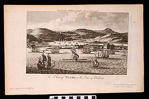
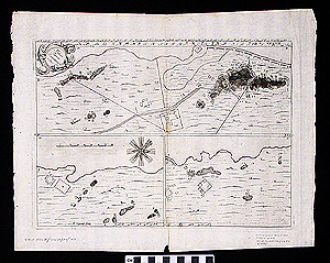
Map: A View of Tunis on the Coast of Barbary1997.11.0046 (1997.11.0046)
36.6 x 23.4 x .1 cm (7 g)
Period: 1778 –1779 CE
Classification/Nomenclature: Communication Artifacts : Documentary Artifacts : Graphic Documents
Classification/Nomenclature: Communication Artifacts : Documentary Artifacts : Graphic Documents
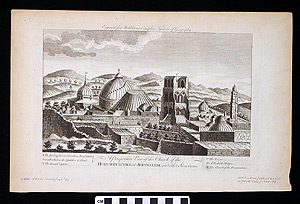
Map: A Perspective View Of The Church Of The Holy Sepulchre At Jerusalem, And Other Structures1997.11.0047 (1997.11.0047)
36.7 x 23.7 x .1 cm (8 g)
Period: 1778-1779 CE
Classification/Nomenclature: Communication Artifacts : Documentary Artifacts : Graphic Documents
Classification/Nomenclature: Communication Artifacts : Documentary Artifacts : Graphic Documents
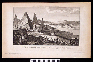
Engraving: The Egyptian Pyramids With A View Of Part Of The Nile &c.1997.11.0048 (1997.11.0048)
36.6 x 22.9 x .1 cm (7 g)
Period: 1778-1779 CE.
Classification/Nomenclature: Communication Artifacts : Documentary Artifacts : Graphic Documents
Classification/Nomenclature: Communication Artifacts : Documentary Artifacts : Graphic Documents
Map: Ottoman Empire1997.11.0049 (1997.11.0049)
38.5 x 32.6 x .1 cm (8 g)
Location: Africa, North; Asia, Central; Asia, South; Asia, West; Europe, East; Europe, West
Period: 1650 CE
Classification/Nomenclature: Communication Artifacts : Documentary Artifacts : Graphic Documents
Period: 1650 CE
Classification/Nomenclature: Communication Artifacts : Documentary Artifacts : Graphic Documents
Map: Ottoman Empire Prutian War1997.11.0050 (1997.11.0050)
41.6 x 32.5 x .1 cm (8 g)
Location: Africa, North; Asia, Central; Asia, South; Asia, West; Europe, East; Europe, West
Period: 1650 CE.
Classification/Nomenclature: Communication Artifacts : Documentary Artifacts : Graphic Documents
Period: 1650 CE.
Classification/Nomenclature: Communication Artifacts : Documentary Artifacts : Graphic Documents
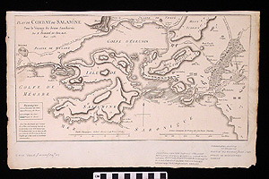
Map: Plan du Combat de Salamine1997.11.0051 (1997.11.0051)
40.1 x 25.9 x .1 cm (23 g)
Period: 1785 CE
Classification/Nomenclature: Communication Artifacts : Documentary Artifacts : Graphic Documents
Classification/Nomenclature: Communication Artifacts : Documentary Artifacts : Graphic Documents
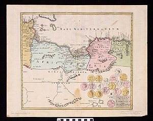
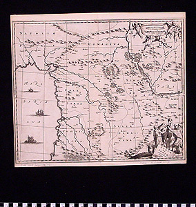
Map: Africa Propria et Cyrenaica1997.11.0052 (1997.11.0052)
47.7 x 37.2 x .1 cm (14 g)
Period: 1712 CE
Classification/Nomenclature: Communication Artifacts : Documentary Artifacts : Graphic Documents
Classification/Nomenclature: Communication Artifacts : Documentary Artifacts : Graphic Documents
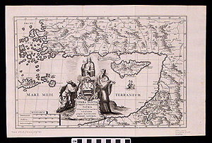
Map: Terra Sancta1997.11.0053 (1997.11.0053)
41.2 x 27 x .1 cm (9 g)
Period: 1699 CE.
Classification/Nomenclature: Communication Artifacts : Documentary Artifacts : Graphic Documents
Classification/Nomenclature: Communication Artifacts : Documentary Artifacts : Graphic Documents
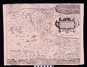
Map: Tribvs Ephraim1997.11.0054 (1997.11.0054)
51.1 x 39.2 x .1 cm (18 g)
Period: 1590 CE
Classification/Nomenclature: Communication Artifacts : Documentary Artifacts : Graphic Documents
Classification/Nomenclature: Communication Artifacts : Documentary Artifacts : Graphic Documents
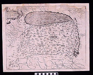
Map: Tribus Juda1997.11.0055 (1997.11.0055)
45.4 x 35.6 x .1 cm (17 g)
Period: 1610 CE
Classification/Nomenclature: Communication Artifacts : Documentary Artifacts : Graphic Documents
Classification/Nomenclature: Communication Artifacts : Documentary Artifacts : Graphic Documents
Map: Tartaria Minor & Crimea1997.11.0056 (1997.11.0056)
63.3 x 53.5 x .1 cm (46 g)
Period: 1745 CE
Classification/Nomenclature: Communication Artifacts : Documentary Artifacts : Graphic Documents
Classification/Nomenclature: Communication Artifacts : Documentary Artifacts : Graphic Documents
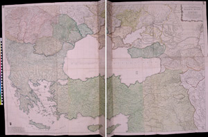
Map: South East Europe1997.11.0057 (1997.11.0057)
137 x 95.1 x .1 cm (234 g)
Period: 1745 CE
Classification/Nomenclature: Communication Artifacts : Documentary Artifacts : Graphic Documents
Classification/Nomenclature: Communication Artifacts : Documentary Artifacts : Graphic Documents
Map: Ancient Africa1997.11.0058 (1997.11.0058)
56 x 44.3 x .1 cm (17 g)
Period: 1700 CE
Classification/Nomenclature: Communication Artifacts : Documentary Artifacts : Graphic Documents
Classification/Nomenclature: Communication Artifacts : Documentary Artifacts : Graphic Documents
Map: Syriae sive Soriae1997.11.0059 (1997.11.0059)
36.3 x 32.2 x .1 cm (10 g)
Period: 1735 CE
Classification/Nomenclature: Communication Artifacts : Documentary Artifacts : Graphic Documents
Classification/Nomenclature: Communication Artifacts : Documentary Artifacts : Graphic Documents
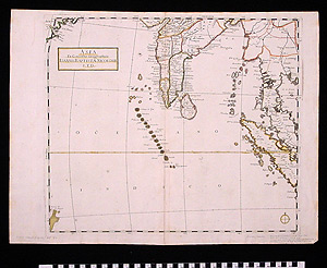
Map: Asia - Ex Conatibus Geographicis1997.11.0060 (1997.11.0060)
56.5 x 42.6 x .1 cm (32 g)
Period: 1610-1670 CE
Classification/Nomenclature: Communication Artifacts : Documentary Artifacts : Graphic Documents
Classification/Nomenclature: Communication Artifacts : Documentary Artifacts : Graphic Documents
Map: Tartary, India, and Far Eastern Asia1997.11.0061 (1997.11.0061)
56.2 x 42.5 x .1 cm (35 g)
Period: 1650 CE
Classification/Nomenclature: Communication Artifacts : Documentary Artifacts : Graphic Documents
Classification/Nomenclature: Communication Artifacts : Documentary Artifacts : Graphic Documents
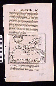
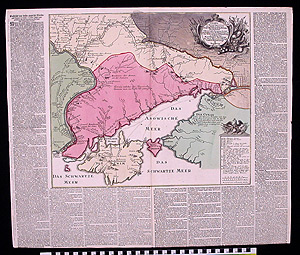
Map: Black Sea1997.11.0062 (1997.11.0062)
35 x 22.3 x .1 cm (5 g)
Period: 1643 CE
Classification/Nomenclature: Communication Artifacts : Documentary Artifacts : Graphic Documents
Classification/Nomenclature: Communication Artifacts : Documentary Artifacts : Graphic Documents
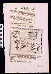
Map: Asiae Antiquae Ora Maritama1997.11.0063 (1997.11.0063)
34.8 x 22.6 x .1 cm (5 g)
Period: 1643 CE
Classification/Nomenclature: Communication Artifacts : Documentary Artifacts : Graphic Documents
Classification/Nomenclature: Communication Artifacts : Documentary Artifacts : Graphic Documents
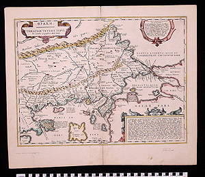
Map: Thraciae Veteris Typus1997.11.0064 (1997.11.0064)
53.2 x 44.4 x .1 cm (36 g)
Period: 1650 CE
Classification/Nomenclature: Communication Artifacts : Documentary Artifacts : Graphic Documents
Classification/Nomenclature: Communication Artifacts : Documentary Artifacts : Graphic Documents
Search Examples
Explore More
Access the public portions of the catalog records for the approximately 50,000 cultural and ethnographic objects in the Museum's Artifact Collection.