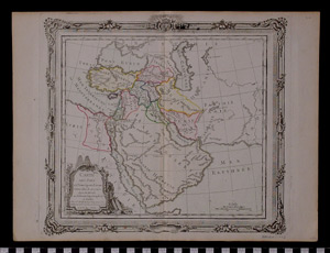
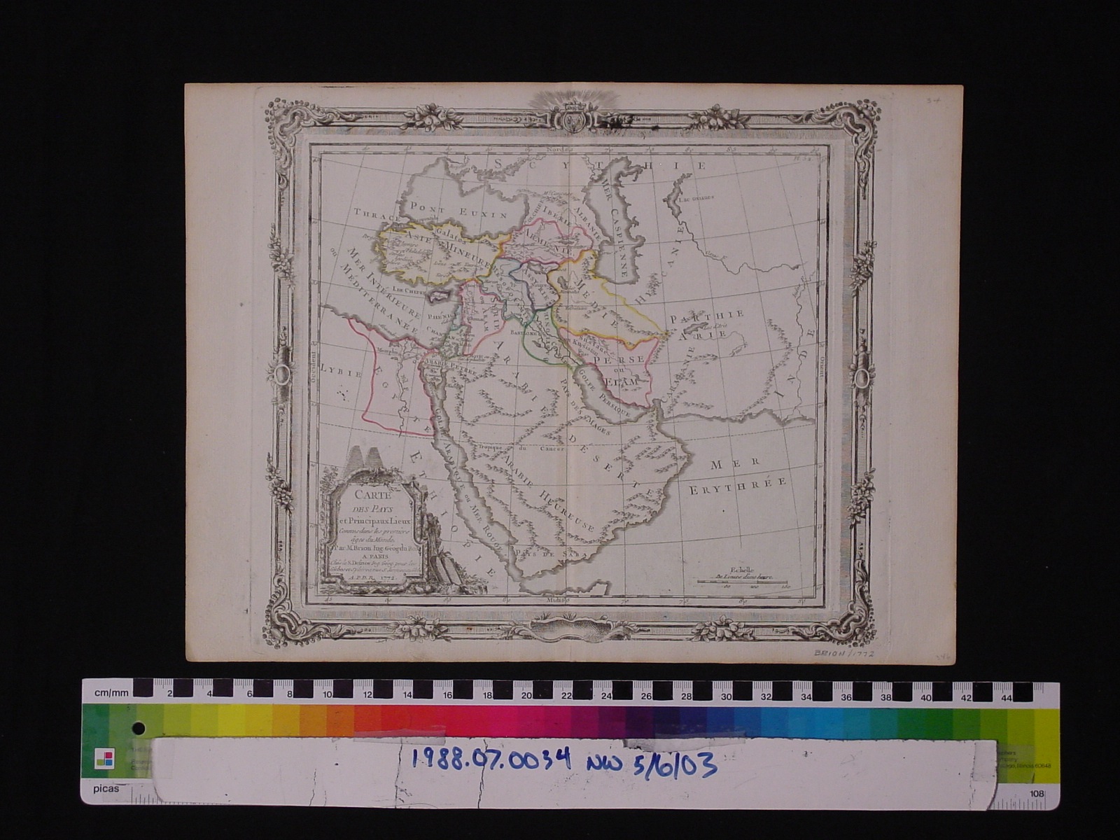
Map: Pays et Principaux Lieux
1988.07.0034
Detailed Images
Basic Information
| Artifact Identification | Map: Pays et Principaux Lieux (1988.07.0034) |
|---|---|
| Classification/ Nomenclature |
|
| Artist/Maker | Brion, De La Tour, Louis. (1756-1823) Louis Charles Desnos: Publisher (1725-1805) |
| Geographic Location | |
| Period | N/A |
| Date | 1772 |
| Culture | French |
| Location | Not on Exhibit |
Physical Analysis
| Dimension 1 (Width) | 38.5 cm |
|---|---|
| Dimension 2 (Height) | 29.1 cm |
| Dimension 3 (Depth) | <0.1 cm |
| Weight | 16 g |
| Measuring Remarks | N/A |
| Materials | paper--rag, pigment--ink |
| Manufacturing Processes | Printed |
Research Remarks
| Description | N/A |
|---|---|
| Published Description | Under Review |
| Bibliography | Brion de la Tour, Louis. Atlas General, civil et Ecclesiastique, methodique et elementaire pour l'etude de la geographie et de l'histoire. Section 16. Paris: Desnos, 1766. Accessed on Google Books. |
Artifact History
| Credit Line/Dedication | The Seymour and Muriel Yale Collection of Coins of the Ottoman Empire and Other Middle East States |
|---|---|
| Reproduction | no |
Contact
All information about our collection is constantly reviewed and updated. Please contact Dery Martínez-Bonilla, Registrar, if there is any information you are looking for that isn't currently online.