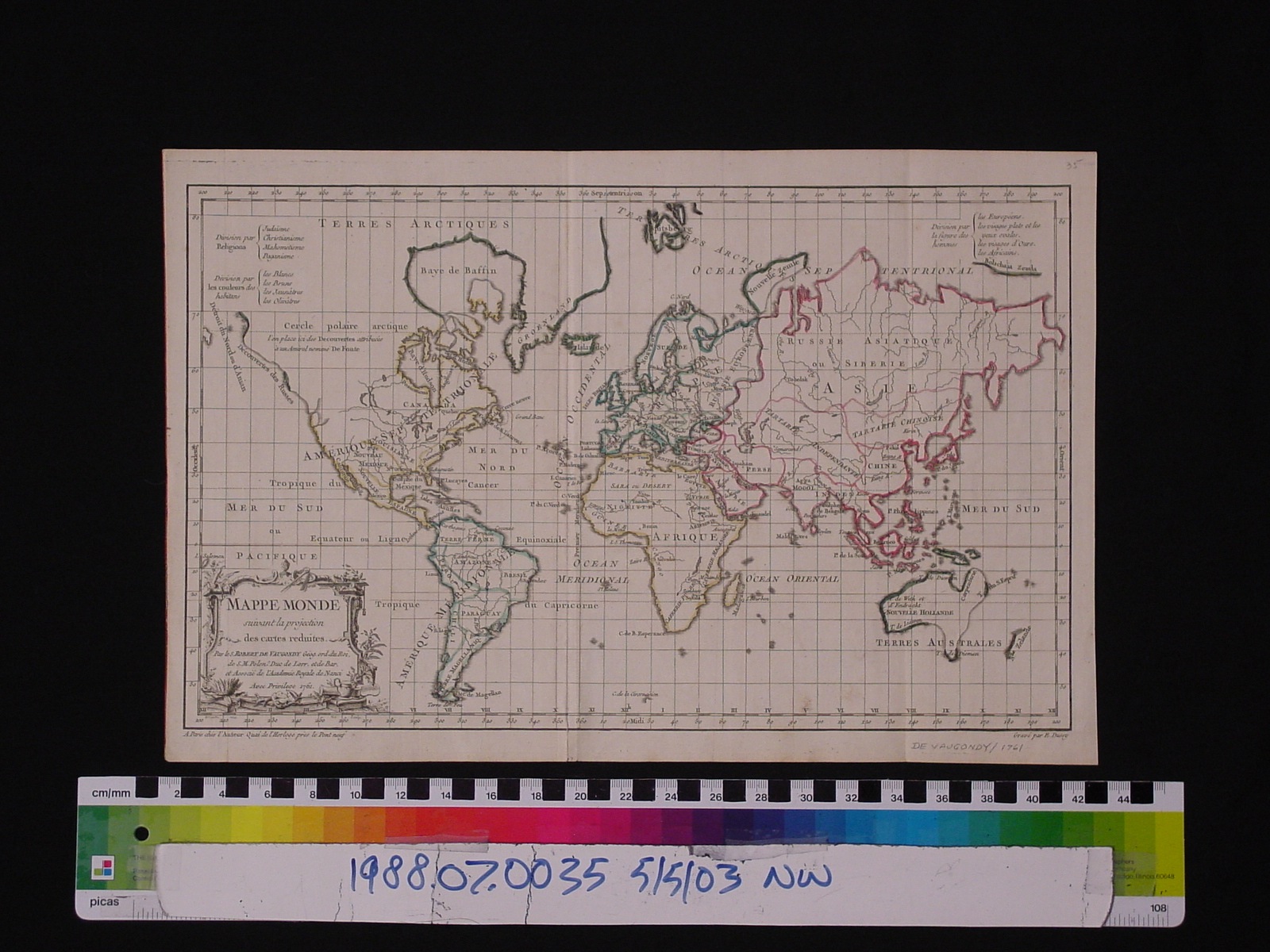
Map: Mappe Monde, Suivant la Projection des Cartes Reduites
1988.07.0035

Detailed Images
Basic Information
| Artifact Identification | Map: Mappe Monde, Suivant la Projection des Cartes Reduites (1988.07.0035) |
|---|---|
| Classification/ Nomenclature |
|
| Artist/Maker | De Vaugondy, Didier Robert: Author, Publisher (1723-1786) E. Dussy: Engraver |
| Geographic Location | |
| Period | N/A |
| Date | 1761 - 1762 |
| Culture | French |
| Location | Not on Exhibit |
Physical Analysis
| Dimension 1 (Width) | 41.2 cm |
|---|---|
| Dimension 2 (Height) | 27.3 cm |
| Dimension 3 (Depth) | <0.1 cm |
| Weight | 11 g |
| Measuring Remarks | N/A |
| Materials | paper, pigment--ink |
| Manufacturing Processes | Printed |
Research Remarks
| Description | N/A |
|---|---|
| Published Description | N/A |
| Bibliography | Wolff, Larry. Inventing Eastern Europe: The Map of civilization on the Mind of Enlightenment. pg. 167-8. Stanford University Press, 1994. Accessed on Google Books. |
Artifact History
| Credit Line/Dedication | The Seymour and Muriel Yale Collection of Coins of the Ottoman Empire and Other Middle East States |
|---|---|
| Reproduction | no |
Contact
All information about our collection is constantly reviewed and updated. Please contact Dery Martínez-Bonilla, Registrar, if there is any information you are looking for that isn't currently online.