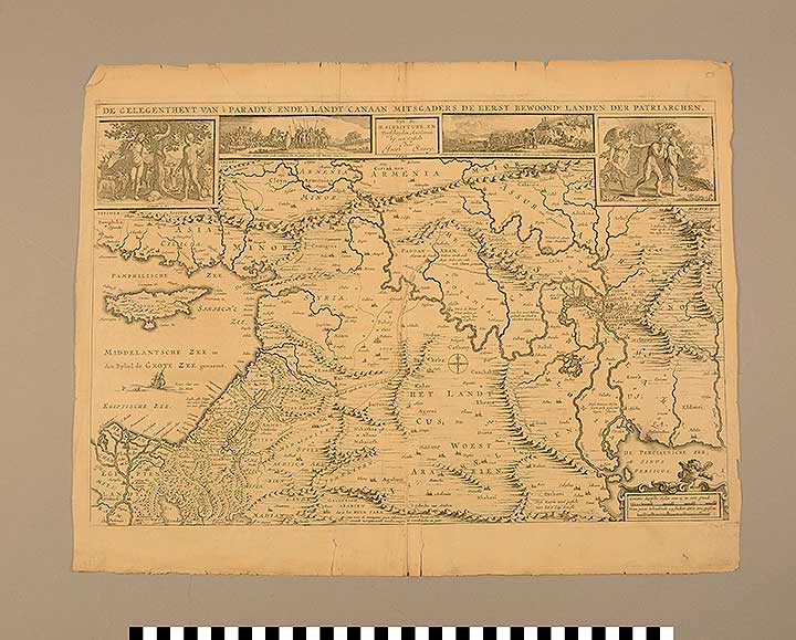
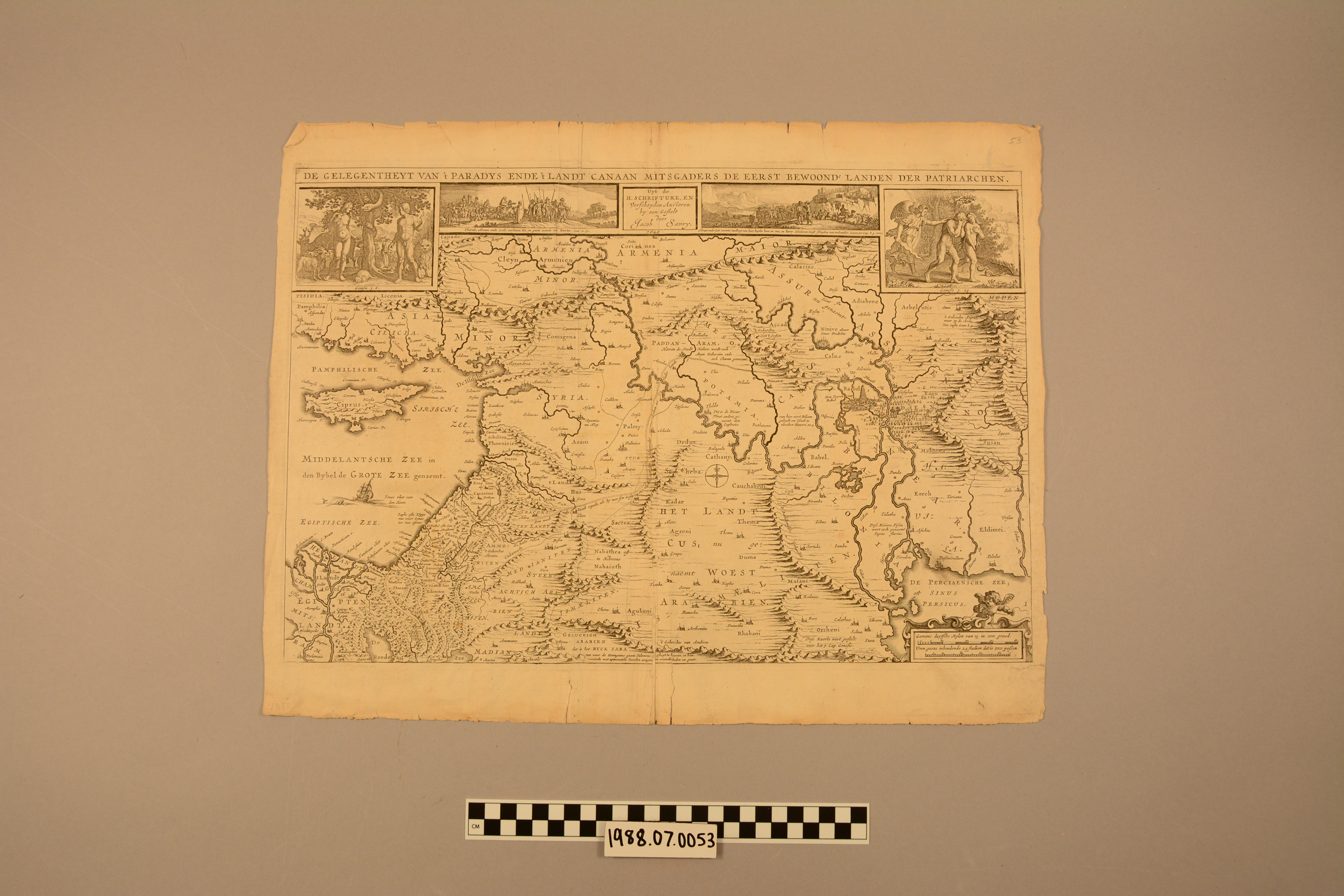
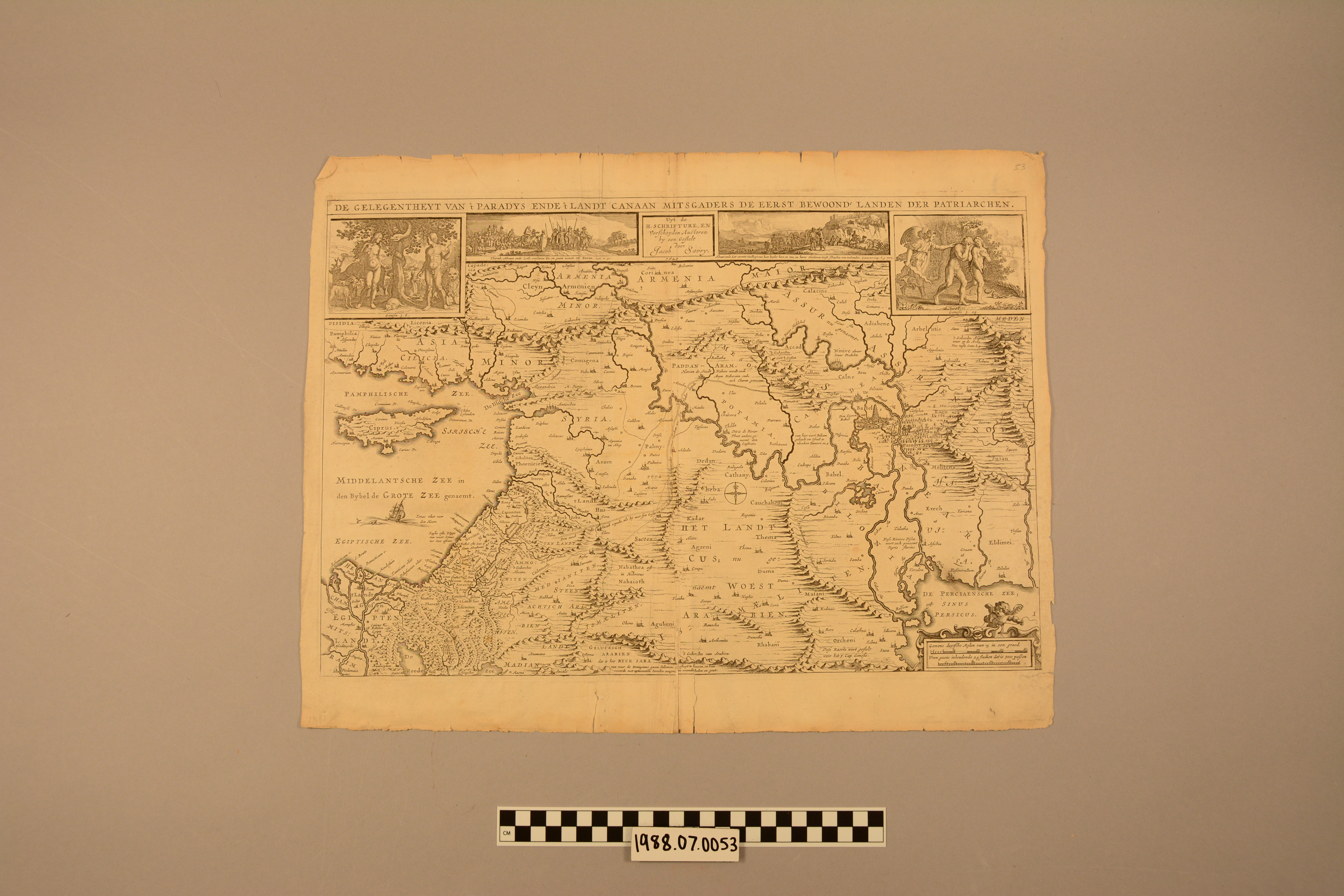
Map: "De Gelegentheyt Van't Paradys Ende't Landt Canaan Mitsgaders De Eerst Bewoonde Landen Der Patriarchen"
1988.07.0053
Detailed Images
Basic Information
| Artifact Identification | Map: "De Gelegentheyt Van't Paradys Ende't Landt Canaan Mitsgaders De Eerst Bewoonde Landen Der Patriarchen" (1988.07.0053) |
|---|---|
| Classification/ Nomenclature |
|
| Artist/Maker | Savry, Jacob (after) Nicolas Visscher |
| Geographic Location | |
| Period | Reformation |
| Date | 1648 |
| Culture | Dutch |
| Location | Not on Exhibit |
Physical Analysis
| Dimension 1 (Width) | 50.0 cm |
|---|---|
| Dimension 2 (Height) | 39.2 cm |
| Dimension 3 (Depth) | <0.1 cm |
| Weight | 16 g |
| Measuring Remarks | N/A |
| Materials | Paper, Pigment--Ink |
| Manufacturing Processes | Printed |
Research Remarks
| Description | N/A |
|---|---|
| Published Description | Under Review |
| Bibliography | Under Review |
Artifact History
| Credit Line/Dedication | The Seymour and Muriel Yale Collection of Coins of the Ottoman Empire and Other Middle East States |
|---|---|
| Reproduction | no |
Contact
All information about our collection is constantly reviewed and updated. Please contact Dery Martínez-Bonilla, Registrar, if there is any information you are looking for that isn't currently online.