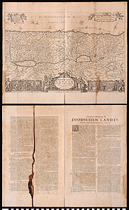
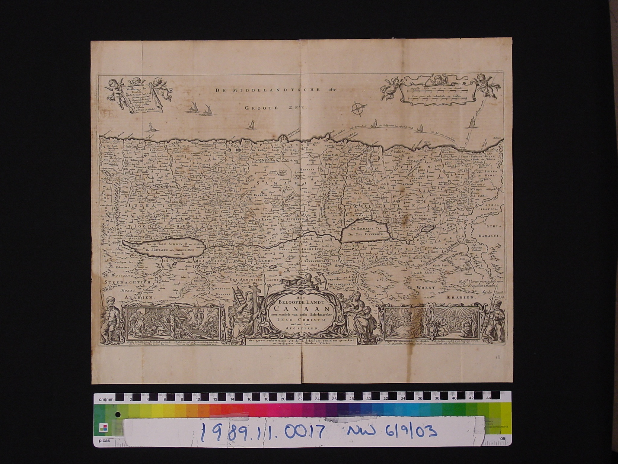
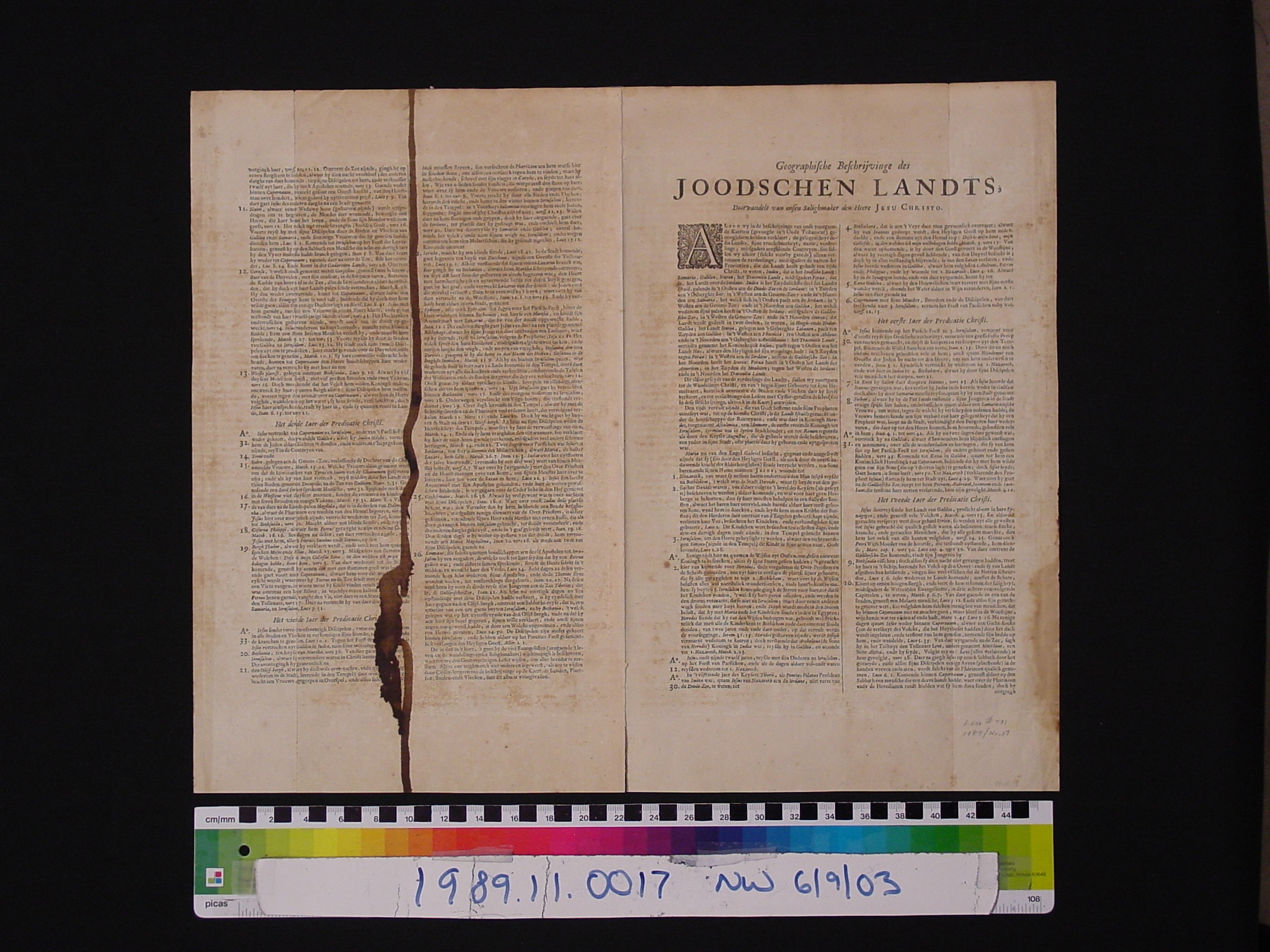
Map: Het Beloofde Landt Canaan door wandelt van onsen Salichmaecker lesu Christo neffens syne Apostelen
1989.11.0017
Detailed Images
Basic Information
| Artifact Identification | Map: Het Beloofde Landt Canaan door wandelt van onsen Salichmaecker lesu Christo neffens syne Apostelen (1989.11.0017) |
|---|---|
| Classification/ Nomenclature |
|
| Artist/Maker | Nicolaes (Nicolaus) Visscher Family of Cartographers, sometimes written Claes Janszoon Visscher 3 generations: I (1587-1652), II (1618-1657), III (1649-1709) A. Broeck: Engraver (possibly Abraham ?) |
| Geographic Location | |
| Period | N/A |
| Date | 1650 CE ? |
| Culture | Dutch |
| Location | Not on Exhibit |
Physical Analysis
| Dimension 1 (Length) | 40.3 cm |
|---|---|
| Dimension 2 (Width) | 49.1 cm |
| Dimension 3 (Depth) | <0.1 cm |
| Weight | N/A |
| Measuring Remarks | N/A |
| Materials | Paper--rag, Pigment--ink |
| Manufacturing Processes | Printed |
Research Remarks
| Description | N/A |
|---|---|
| Published Description | Under Review |
| Bibliography | Laor, Eran. Maps of the Holy Land: Cartobibliography of Printed Maps, 1475-1900. New York: A. R. Liss, 1986. Catalog #791, 809, 810. |
Artifact History
| Credit Line/Dedication | The Seymour and Muriel Yale Collection of Coins of the Ottoman Empire and Other Middle East States |
|---|---|
| Reproduction | no |
Contact
All information about our collection is constantly reviewed and updated. Please contact Dery Martínez-Bonilla, Registrar, if there is any information you are looking for that isn't currently online.