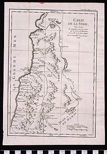
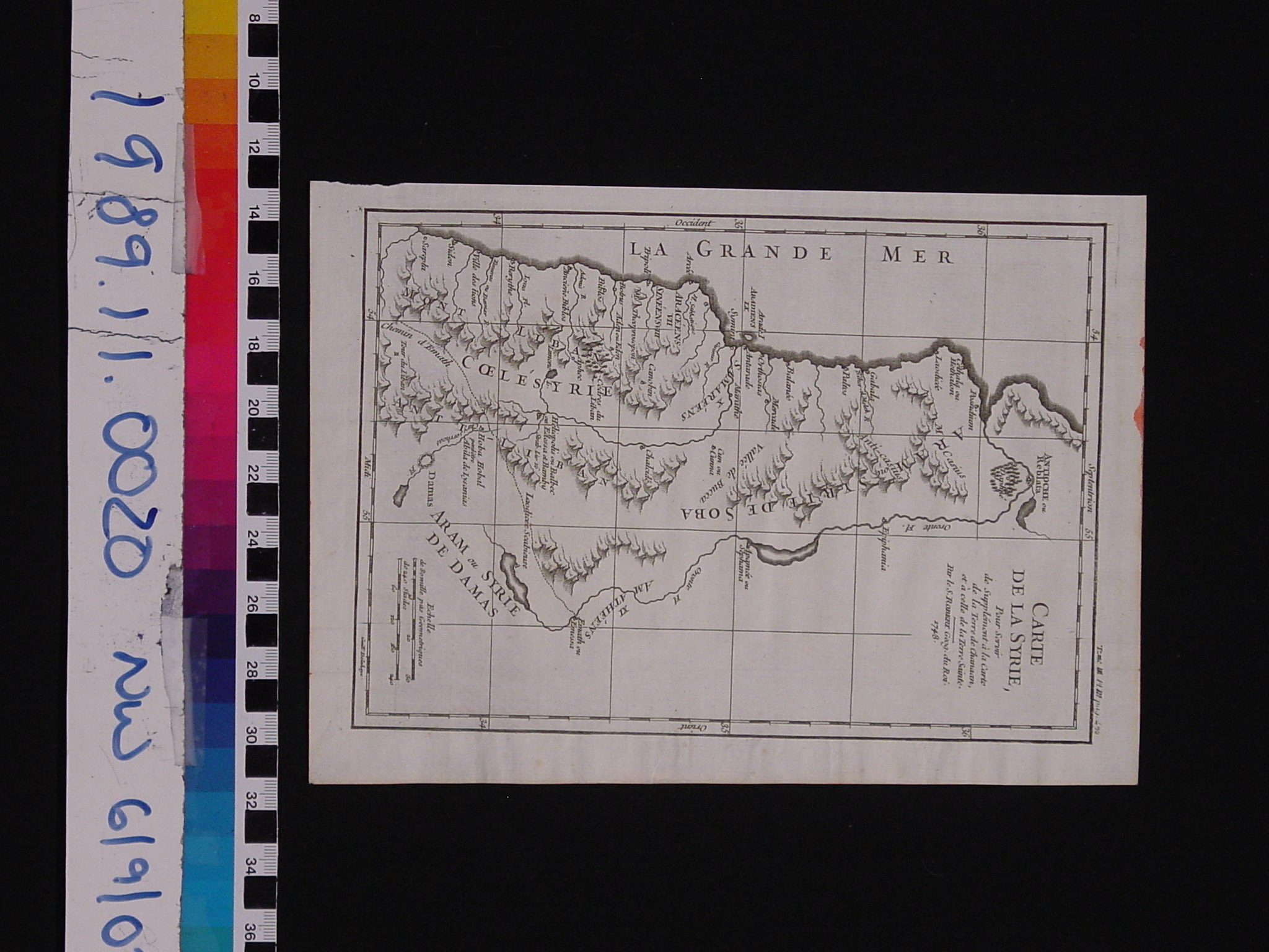
Map: Carte de la Syrie
1989.11.0020
Detailed Images
Basic Information
| Artifact Identification | Map: Carte de la Syrie (1989.11.0020) |
|---|---|
| Classification/ Nomenclature |
|
| Artist/Maker | de vaugondy, robert Gilles (1688-1766), Didier (1723-1786) delahaye, guillaume: Engraver (1725-1802) |
| Geographic Location | |
| Period | N/A |
| Date | 1748 CE |
| Culture | French |
| Location | Not on Exhibit |
Physical Analysis
| Dimension 1 (Length) | 25.3 cm |
|---|---|
| Dimension 2 (Width) | 18.5 cm |
| Dimension 3 (Depth) | <0.1 cm |
| Weight | 3 g |
| Measuring Remarks | N/A |
| Materials | Paper--rag, Pigment--ink |
| Manufacturing Processes | Printed |
Research Remarks
| Description | N/A |
|---|---|
| Published Description | Under Review |
| Bibliography | Hitti, Philip K. The Near East. P.118, "The Syrian Kingdom." Princeton, N.J.: D. Van Nordstrand Company, Inc., 1961. |
Artifact History
| Credit Line/Dedication | The Seymour and Muriel Yale Collection of Coins of the Ottoman Empire and Other Middle East States |
|---|---|
| Reproduction | No |
Contact
All information about our collection is constantly reviewed and updated. Please contact Dery Martínez-Bonilla, Registrar, if there is any information you are looking for that isn't currently online.