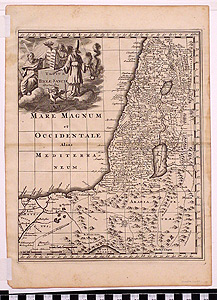
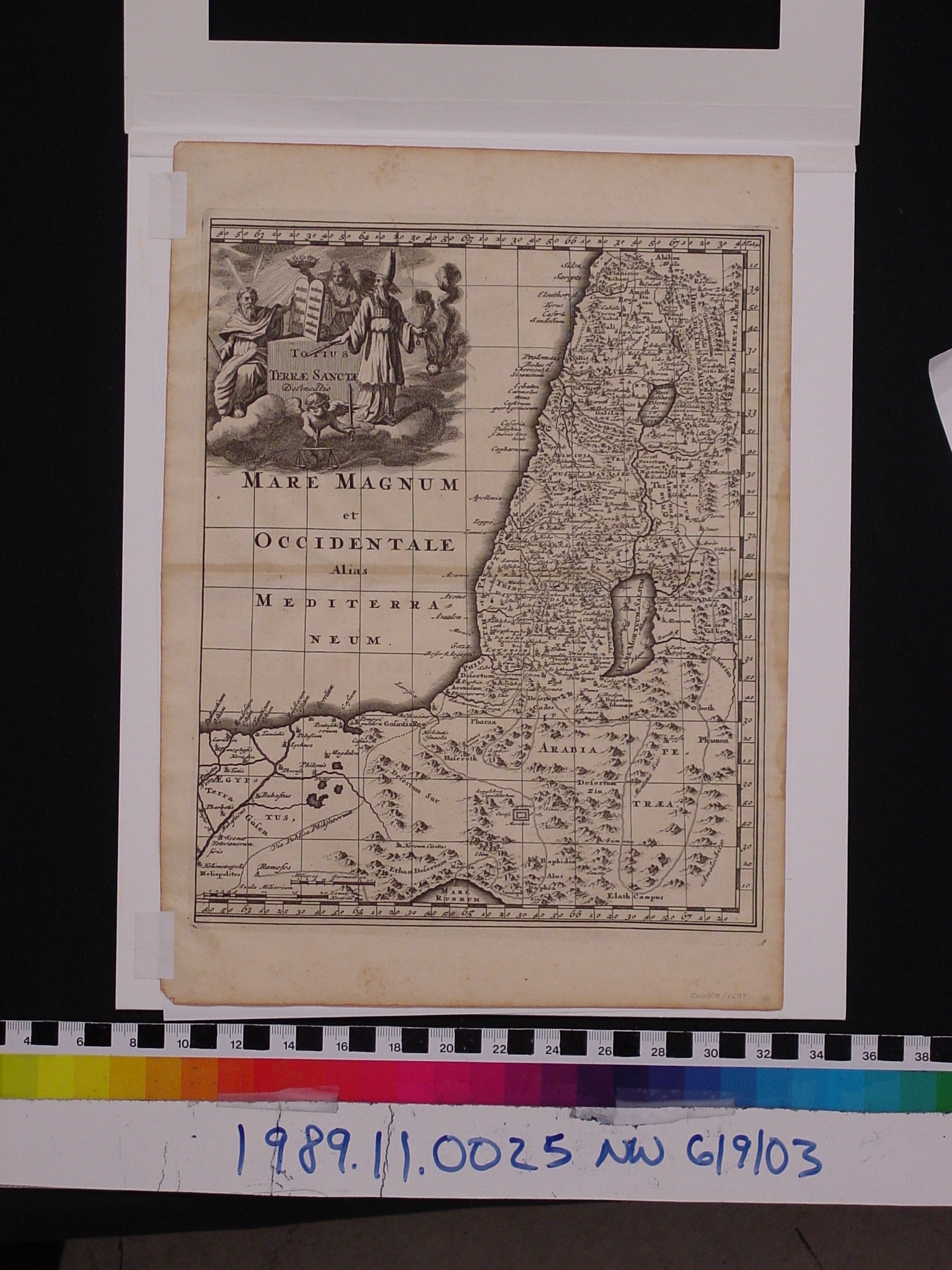
Map: Totius Terre Sancte Delineatio
1989.11.0025
Detailed Images
Basic Information
| Artifact Identification | Map: Totius Terre Sancte Delineatio (1989.11.0025) |
|---|---|
| Classification/ Nomenclature |
|
| Artist/Maker | Cluver, Philipp ( Philippi Cluverii and Philippus Cluverius ) (1580-1622) Joannes Wolters: Publisher *Additional publication contributors: Editorial Notes: Johannes Buno Annotations & Addenda: Johann Friedrich Heckel & Johannes Reiske |
| Geographic Location | |
| Period | N/A |
| Date | 1697 CE |
| Culture | N/A |
| Location | Not on Exhibit |
Physical Analysis
| Dimension 1 (N/A) | 32.5 cm |
|---|---|
| Dimension 2 (N/A) | 23.7 cm |
| Dimension 3 (N/A) | N/A |
| Weight | 120.0 g |
| Measuring Remarks | Under Review |
| Materials | Paper--rag, Pigment--ink |
| Manufacturing Processes | Printed |
Research Remarks
| Description | N/A |
|---|---|
| Published Description | Under Review |
| Bibliography | Encyclopaedia Britannica. "Philipp Clüver." Encyclopaedia Britannica Online Academic Edition. Encyclopædia Britannica Inc., 2014. |
Artifact History
| Credit Line/Dedication | The Seymour and Muriel Yale Collection of Coins of the Ottoman Empire and Other Middle East States |
|---|---|
| Reproduction | No |
Contact
All information about our collection is constantly reviewed and updated. Please contact Dery Martínez-Bonilla, Registrar, if there is any information you are looking for that isn't currently online.