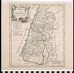
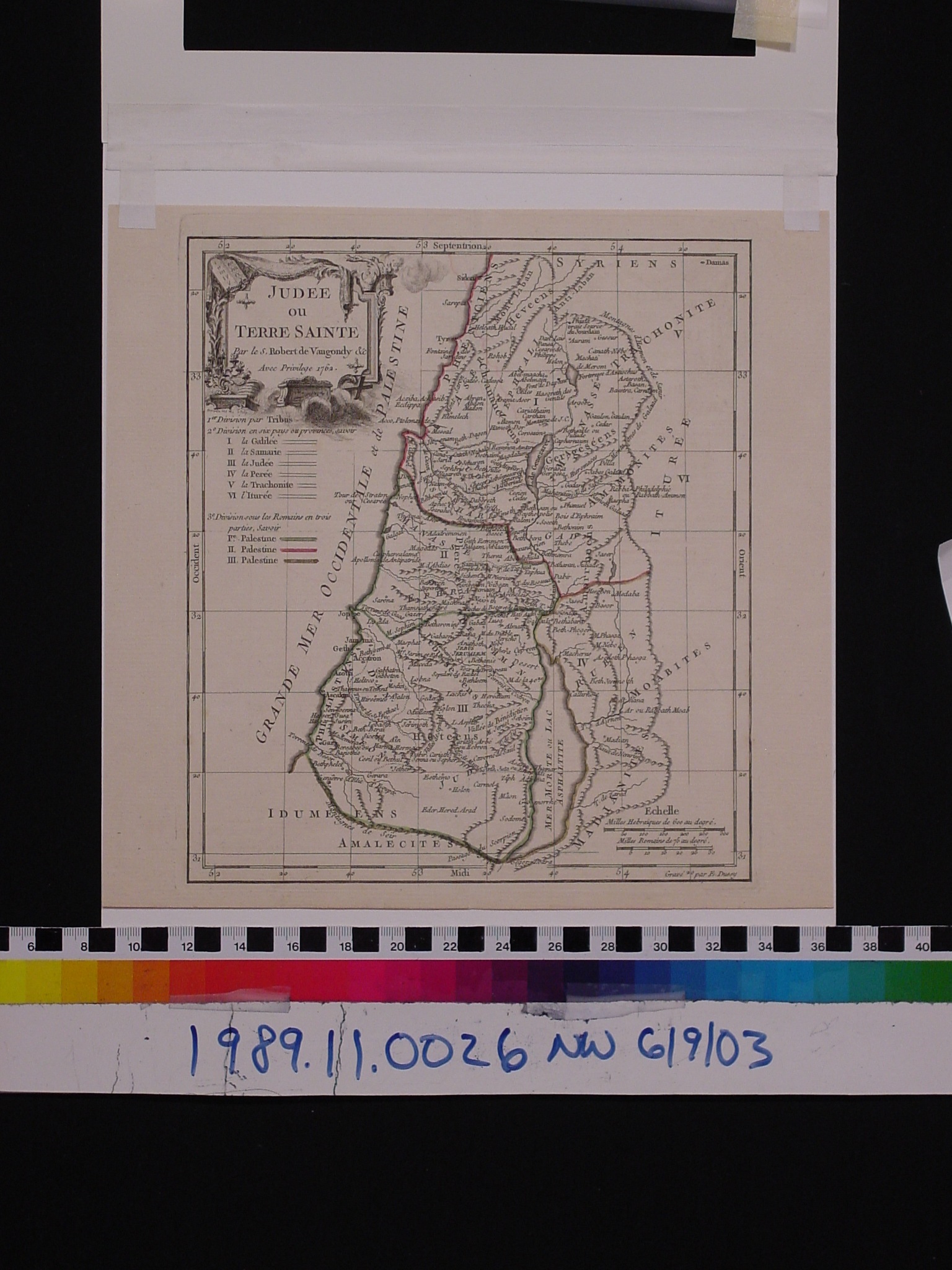
Map: Judee ou Terre Sainte
1989.11.0026
Detailed Images
Basic Information
| Artifact Identification | Map: Judee ou Terre Sainte (1989.11.0026) |
|---|---|
| Classification/ Nomenclature |
|
| Artist/Maker | Vaugondy, Gilles Robert de (1688-1766) Vaugondy, Didler Robert de (1723-1786) E. Dussy: Engraver |
| Geographic Location | |
| Period | N/A |
| Date | 1762 CE |
| Culture | French |
| Location | Not on Exhibit |
Physical Analysis
| Dimension 1 (N/A) | 27.4 cm |
|---|---|
| Dimension 2 (N/A) | 26.5 cm |
| Dimension 3 (N/A) | N/A |
| Weight | 125.0 g |
| Measuring Remarks | Under Review |
| Materials | Paper--rag, Pigment--ink |
| Manufacturing Processes | Printed |
Research Remarks
| Description | N/A |
|---|---|
| Published Description | Under Review |
| Bibliography | WorldCat. Judee ou Terre Sainte by Gilles Robert de Vaugondy. Engraved by E. Dussy. From Nouvel atlas Portatif. Paris: Charles-Francois Delamarche, 1762. |
Artifact History
| Credit Line/Dedication | The Seymour and Muriel Yale Collection of Coins of the Ottoman Empire and Other Middle East States |
|---|---|
| Reproduction | No |
Contact
All information about our collection is constantly reviewed and updated. Please contact Dery Martínez-Bonilla, Registrar, if there is any information you are looking for that isn't currently online.