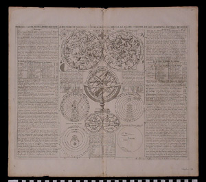
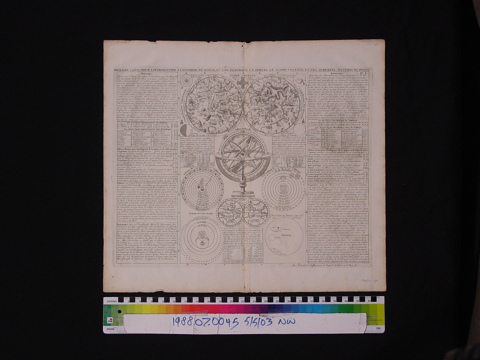
Map: Premiere Carte pour l'Introduction a l'Histoire du Monde, ou l'on remarque la sphere, le globe celeste, etl es differens sistemes du monde
1988.07.0045
Detailed Images
Basic Information
| Artifact Identification | Map: Premiere Carte pour l'Introduction a l'Histoire du Monde, ou l'on remarque la sphere, le globe celeste, etl es differens sistemes du monde (1988.07.0045) |
|---|---|
| Classification/ Nomenclature |
|
| Artist/Maker | Chatelain, Henri Abraham OR Zacharie: Publisher (H.A. 1684-1743) (Z. Sr. d.1723) (Z. Jr. 1690-1754) Nicholas Gueudeville: Editor, Text (1652-172?) |
| Geographic Location | |
| Period | N/A |
| Date | 1719 |
| Culture | French |
| Location | Not on Exhibit |
Physical Analysis
| Dimension 1 (Width) | 49.1 cm |
|---|---|
| Dimension 2 (Length) | 43.7 cm |
| Dimension 3 (N/A) | N/A |
| Weight | 25 g |
| Measuring Remarks | N/A |
| Materials | paper, pigment--ink |
| Manufacturing Processes | printing |
Research Remarks
| Description | N/A |
|---|---|
| Published Description | N/A |
| Bibliography | Goffart, Walter. Historical Atlases: The First Three hundred Years, 1570-1870. Pg. 132-133. Chicago: University of Chicago Press, 2003. |
Artifact History
| Credit Line/Dedication | The Seymour and Muriel Yale Collection of Coins of the Ottoman Empire and Other Middle East States |
|---|---|
| Reproduction | no |
Contact
All information about our collection is constantly reviewed and updated. Please contact Dery Martínez-Bonilla, Registrar, if there is any information you are looking for that isn't currently online.